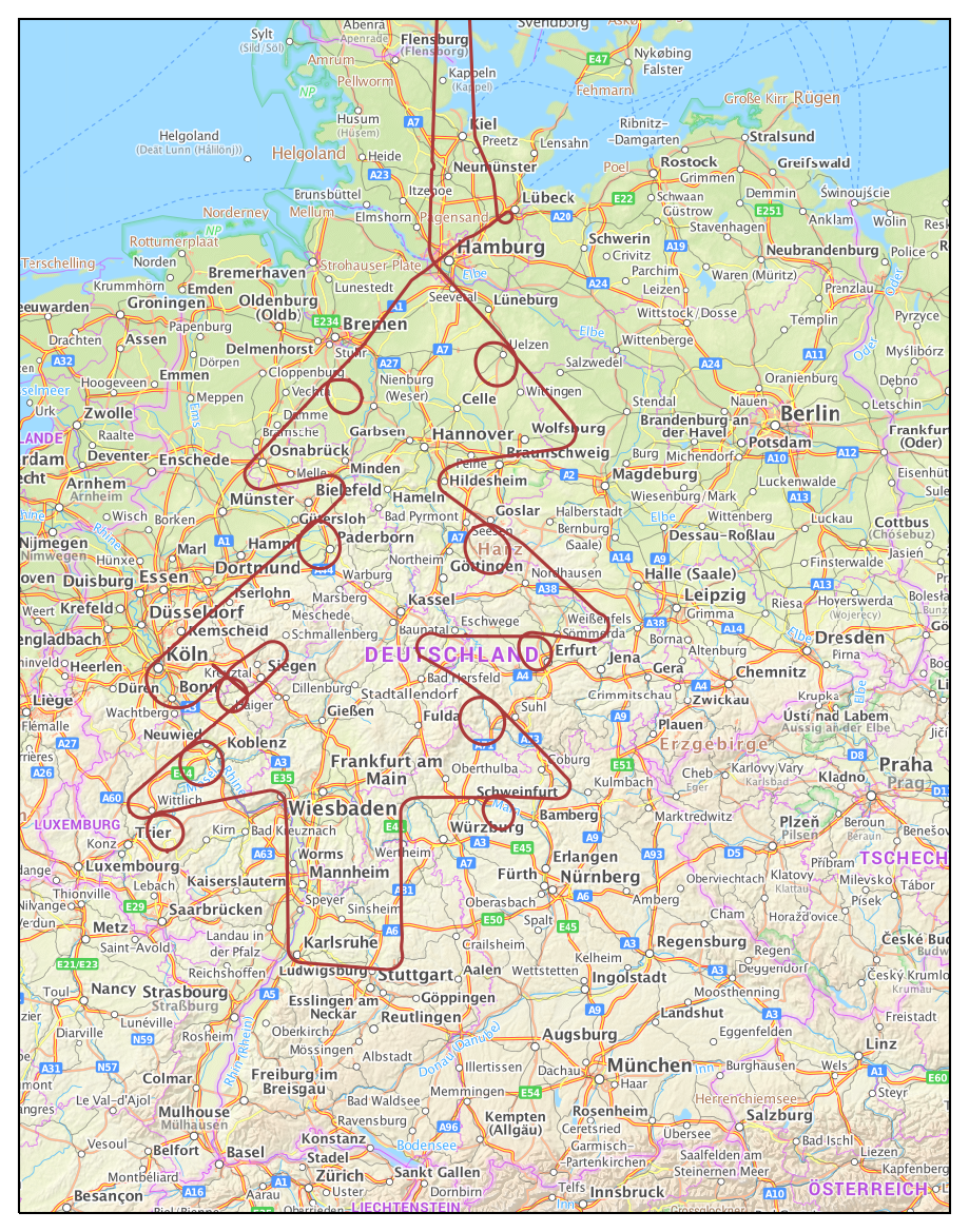
Introducing cartotools with Airbus Christmas tree
Before Christmas leave, just a small snippet of code for plotting the trajectory of Airbus flight AIB232E. The data has been made available by the OpenSky Network. It is plotted using my new cartotools library (built on top of Cartopy).
You may download the data here.
%matplotlib inline
import matplotlib.pyplot as plt

import pandas as pd

from cartotools.crs import PlateCarree
from cartotools.img_tiles import BKG_Topoplus

tiles = BKG_Topoplus()

fig = plt.figure(figsize=(15, 10), dpi=150)
ax = fig.add_subplot(111, projection=tiles.crs)

ax.add_image(tiles, 7, alpha=.7)

ax.set_extent((5.5, 15.23, 47.215, 55.03))

tree = pd.read_csv("airbus_tree.csv", index_col=0)
ax.plot(tree.lon, tree.lat, color='#aa3a3a', transform=PlateCarree())