Flying from New York to Beijing
Looking at history data of Flight UA89 from New York Newark (KEWR) to Beijing (ZBAA), I found a fun artefact: some trajectories head westwards (blue lines) while on other days, they head eastwards (red lines). Notice the gaps for poor coverage areas on FlightRadar24.
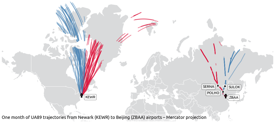
Indeed, if you look at the coordinates for both airports, they are both located at same latitudes on both sides of the planet. The shortest route (great circle) flies not far from the North Pole and winds will determine the most efficient way to reach the destination.
>>> from traffic.data import airports
>>> airports["KEWR"].latlon
(40.692501, -74.168602)
>>> airports["ZBAA"].latlon
(40.084152, 116.592735)
Looking from above, the same map yields a different impression:
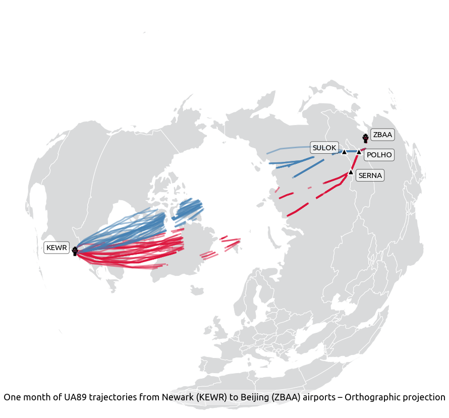
It is also quite interesting to see how traffic organises in a more flexible manner on the American side than on the Chinese side. There is a fair share of variance, or dispersion in longitude on the American side whereas aircraft follow routes in a more strict way on the Chinese side (navigational points displayed for reference).


